Cartography

Some guidelines about cartography.
The fundamental uses of traditional cartography are to:
Set the map’s agenda and select traits of the object to be mapped. This is the concern of map editing. Traits may be physical, such as roads or land masses, or may be abstract, such as toponyms, mountains elevation, villages or political boundaries.
Represent the terrain of the mapped object on flat media. This is the concern of map projections
Eliminate characteristics of the mapped object that are not relevant to the map’s purpose. This is the concern of generalization.
Reduce the complexity of the characteristics that will be mapped. This is also the concern of generalization.
Orchestrate the elements of the map to best convey its message to its audience. This is the concern of map desing.
Modern cartography constitutes many theoretical and practical foundations of goegraphic information systems.
Globe principals
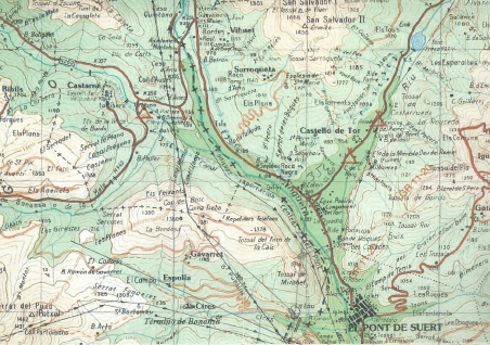
Cartography is esencial hiking in mountain landscape. Please see the principales in this pdf. Presentació Networking_Cartography
 BarcelonaWalking Barcelona Hiking Barcelona Montserrat Costa Brava Pyrenees